Photos


Request Notification
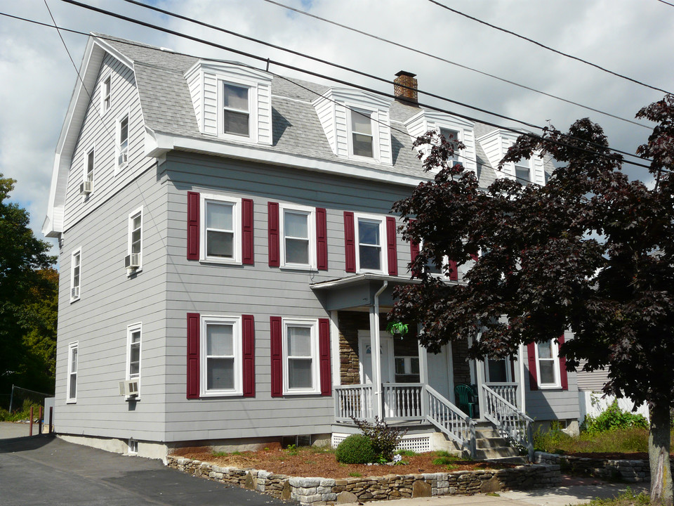
11-13 High St
Malden, MA 02148

- 2 Bedroom Bedrooms
About 11-13 High St
Experience a new place to live at 11-13 High St in Malden. The location in Malden's Ferryway area has much to offer its residents. Here at this community, the team of leasing professionals is ready to help you in finding your perfect floorplan. Welcome to your new home at 11-13 High St. Stop by the leasing office to check the current floorplan availability.
Description created using real-time rental pricing and availability.
11-13 High St is located in the Ferryway Neighborhood and 02148 Zip code of Malden, MA.
Property Contact Info
Floorplan Pricing and Availability
New! Interactive Property Map
2 Bedrooms
2 Beds, 1 bath
2 Beds, 1 BathAvailability Details
Availability Date Unit Unavailable 2 Beds, 1 bath
Property Information
- 4 Units
- 3 Stories
- Built in 1920
Map
- Shopping
- Colleges
- Grocery
- Medical
- Parks
- Transportation
- Nearby Properties

Map
What Are Walk Score®, Transit Score®, and Bike Score® Ratings?
- Walk Score® measures the walkability of any address.
- Transit Score® measures access to public transit.
- Bike Score® measures the bikeability of any address.
Renters Reviews and Ratings
Nearby Schools
Malden High
Ferryway
Beebe
About GreatSchools Data on ApartmentHomeLiving.com.
Points of Interest
Time and distance from 11-13 High St.
Arts Museums and Landmarks
Big Box and Retail
Autozone
Target
Walgreens
Colleges and Universities
Groceries
Market Basket
Stop & Shop
Pricerite
Hospitals
Melrosewakefield Healthcare
Cambridge Health Alliance
Shriners Hospital For Children - Boston
Military Bases
Boston Support Center
Fort Pickering
Parks and Recreation
11-13 High St has 5 parks within 4.5 miles, including The Boston Public Garden, Boston Common, Freedom Trail, New England Holocaust Museum, and Boston Islands National Park.
Restaurants and Dining
Shopping Centers
11-13 High St has 5 shopping centers within 0.8 miles.
Nearby Neighborhoods
Rental Price Ranges in the Area
| Bedroom | Average Price | Cheapest Price | Highest Price |
|---|---|---|---|
| Malden Studio Apartments | $2,338 | $1,550 | $4,151 |
| Malden 1 Bedroom Apartments | $2,699 | $1,165 | $6,173 |
| Malden 2 Bedroom Apartments | $3,295 | $1,150 | $9,639 |
| Malden 3 Bedroom Apartments | $3,621 | $900 | $8,692 |
| Malden 4 Bedroom Apartments | $4,209 | $900 | $6,500 |
| Malden 5 Bedroom Apartments | $5,851 | $1,200 | $7,995 |
| Malden 6 Bedroom Apartments | $6,540 | $5,500 | $7,700 |
Nearby Apartments
Nearby Homes
Did You Know?
The months of July-August show the most apartment renter searches in Massachusetts.