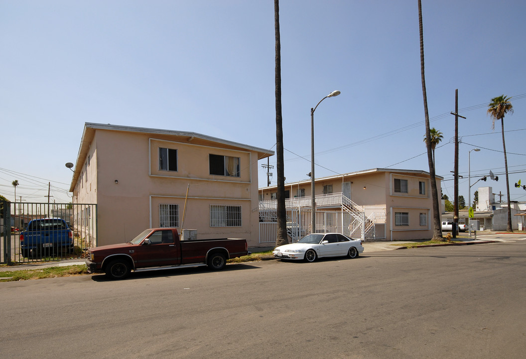
Photos


Request Notification
452 W 67th St
Los Angeles, CA 90003

- 2 Bedroom Bedrooms
- 697Square Feet
About 452 W 67th St
Find your new home at 452 W 67th St. The address for this community is in the South Central LA area of Los Angeles. The leasing staff is ready and waiting to help you find your perfect floorplan. So get a head start on your move. Contact or stop by the 452 W 67th St leasing office to check the availability and schedule a tour today.
Description created using real-time rental pricing and availability.
452 W 67th St is located in the South Central LA Neighborhood and 90003 Zip code of Los Angeles, CA.
Property Contact Info
Floorplan Pricing and Availability
New! Interactive Property Map
2 Bedrooms
2 Beds, 1 bath
2 Beds, 1 Bath, 697 sq ftAvailability Details
Availability Date Unit Sq Ft Unavailable 2 Beds, 1 bath 697 sq ft
Property Information
- 16 Units
- 2 Stories
- Built in 1957
You are leaving ApartmentHomeLiving.com…
Fees and Policies
Parking Info and Fees
- Surface LotiParking Available
Property Fee Disclaimer: Based on community-supplied data and independent market research. Subject to change without notice. May exclude fees for mandatory or optional services and usage-based utilities.
Map
- Shopping
- Colleges
- Grocery
- Medical
- Parks
- Transportation
- Nearby Properties

Map
What Are Walk Score®, Transit Score®, and Bike Score® Ratings?
- Walk Score® measures the walkability of any address.
- Transit Score® measures access to public transit.
- Bike Score® measures the bikeability of any address.
Renters Reviews and Ratings
Nearby Schools
Gil Garcetti Learning Academy
Mary McLeod Bethune Middle
John C. Fremont Senior High
About GreatSchools Data on ApartmentHomeLiving.com.
Points of Interest
Time and distance from 452 W 67th St.
Arts Museums and Landmarks
Big Box and Retail
Autozone
Jcpenney
Colleges and Universities
University of Southern California - University Park Campus
United Education Institute, Huntington Park - Huntington Park Campus
Groceries
El Super
Smart & Final
Central Market
Hospitals
Military Bases
Los Angeles Air Force Base
National Guard Armory South Bay Cities
Parks and Recreation
452 W 67th St has 5 parks within 9.9 miles, including Exposition Rose Garden, La Brea Tarpits, Barnsdall Art Park, Beverly Gardens Park, and Bronson Canyon.
Restaurants and Dining
Shopping Centers
452 W 67th St has 5 shopping centers within 1.1 miles.
Transit Stations
Nearby Neighborhoods
Rental Price Ranges in the Area
| Bedroom | Average Rent | Cheapest Rent | Highest Rent |
|---|---|---|---|
| Los Angeles Studio Apartments | $2,128 | $621 | $10,000+ |
| Los Angeles 1 Bedroom Apartments | $2,705 | $645 | $10,000+ |
| Los Angeles 2 Bedroom Apartments | $3,513 | $798 | $10,000+ |
| Los Angeles 3 Bedroom Apartments | $5,070 | $700 | $10,000+ |
| Los Angeles 4 Bedroom Apartments | $4,038 | $850 | $10,000+ |
| Los Angeles 5 Bedroom Apartments | $4,658 | $999 | $10,000+ |
| Los Angeles 6 Bedroom Apartments | $8,900 | $8,100 | $10,000+ |
| Los Angeles 7 Bedroom Apartments | $1,831 | $1,085 | $9,800 |
Nearby Apartments
Nearby Homes
Did You Know?
The average Studio Apartment in Los Angeles is $2,128.