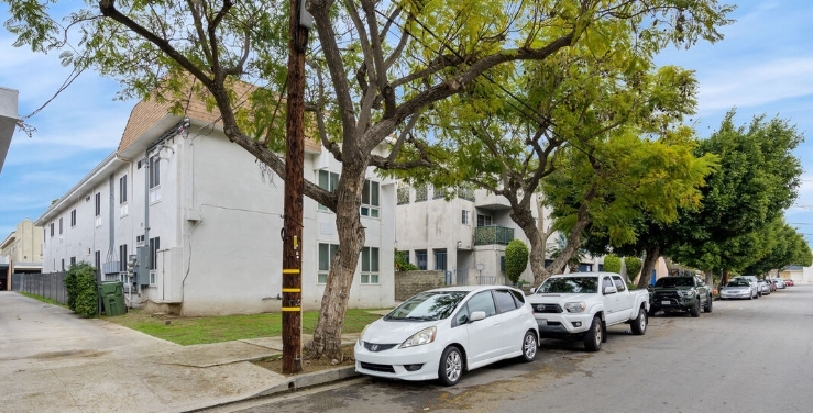
Photos


Request Notification
133 Lime St
Inglewood, CA 90301

- 1–3 Bedrooms
About 133 Lime St
Experience Inglewood living at 133 Lime St. The location in Inglewood's area is an ideal place for residents. Here at this community, the professional leasing staff will be ready to help you find the perfect new place. Stop by to ask about the current floorplan availability.
Description created using real-time rental pricing and availability.
133 Lime St is located in the 90301 Zip code of Inglewood, CA.
Property Contact Info
Floorplan Pricing and Availability
New! Interactive Property Map
1 Bedroom
1 Bed, 1 bath
1 Bed, 1 BathAvailability Details
Availability Date Unit Unavailable 1 Bed, 1 bath 2 Bedrooms
2 Beds, 2 baths
2 Beds, 2 BathsAvailability Details
Availability Date Unit Unavailable 2 Beds, 2 baths 3 Bedrooms
3 Beds, 2 baths
3 Beds, 2 BathsAvailability Details
Availability Date Unit Unavailable 3 Beds, 2 baths
Property Information
- 5 Units
- Built in 1966
- 2 Stories
Map
- Shopping
- Colleges
- Grocery
- Medical
- Parks
- Transportation
- Nearby Properties

Map
Getting Around
Walk Score®
87 / 100
Very Walkable
Most errands can be accomplished on foot
Bike Score®
62 / 100
Bikeable
Some bike infrastructure
Transit Score®
54 / 100
Good Transit
Many nearby public transportation options
What Are Walk Score®, Transit Score®, and Bike Score® Ratings?
- Walk Score® measures the walkability of any address.
- Transit Score® measures access to public transit.
- Bike Score® measures the bikeability of any address.
Renters Reviews and Ratings
Nearby Schools
Crozier (George W.) Middle
Hudnall (Claude) Elementary
Inglewood High
About GreatSchools Data on ApartmentHomeLiving.com.
Points of Interest
Time and distance from 133 Lime St.
Arts Museums and Landmarks
Big Box and Retail
Colleges and Universities
Groceries
Hospitals
Military Bases
Parks and Recreation
133 Lime St has 5 parks within 10.5 miles, including Exposition Rose Garden, La Brea Tarpits, Beverly Gardens Park, Santa Monica Pier, and Barnsdall Art Park.
Restaurants and Dining
Shopping Centers
133 Lime St has 5 shopping centers within 0.5 miles.
Transit Stations
Nearby Neighborhoods
Rental Price Ranges in the Area
| Bedroom | Average Rent | Cheapest Rent | Highest Rent |
|---|---|---|---|
| Inglewood Studio Apartments | $2,112 | $812 | $4,738 |
| Inglewood 1 Bedroom Apartments | $2,505 | $895 | $6,661 |
| Inglewood 2 Bedroom Apartments | $3,097 | $929 | $7,070 |
| Inglewood 3 Bedroom Apartments | $3,810 | $1,200 | $6,670 |
| Inglewood 4 Bedroom Apartments | $4,452 | $925 | $7,899 |
| Inglewood 5 Bedroom Apartments | $3,800 | $3,800 | $3,800 |
Nearby Apartments
Nearby Homes
Did You Know?
22% of apartment shoppers plan to spend 4-6 months in their apartment search.