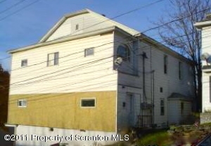
Photos


Request Notification
211 Pancoast St
Throop, PA 18512

- 2 Bedroom Bedrooms
- 525–701Square Feet
About 211 Pancoast St
At 211 Pancoast St, experience fine living. These apartments are located in the 18512 area of Throop. The community staff will be ready to help you find your new home. Drop by to find out the current floorplan availability.
Description created using real-time rental pricing and availability.
211 Pancoast St is located in the 18512 Zip code of Throop, PA.
Property Contact Info
Floorplan Pricing and Availability
New! Interactive Property Map
2 Bedrooms
2 Beds, 1 bath
2 Beds, 1 Bath, 525-701 sq ftAvailability Details
Availability Date Unit Sq Ft Unavailable 2 Beds, 1 bath 525-701 sq ft
Property Information
- 5 Units
- 2 Stories
- Built in 1920
Map
- Shopping
- Colleges
- Grocery
- Medical
- Parks

Map
Getting Around
Walk Score®
13 / 100
Car-Dependent
Almost all errands require a car
Bike Score®
32 / 100
Somewhat Bikeable
Minimal bike infrastructure
What Are Walk Score®, Transit Score®, and Bike Score® Ratings?
- Walk Score® measures the walkability of any address.
- Transit Score® measures access to public transit.
- Bike Score® measures the bikeability of any address.
Renters Reviews and Ratings
Nearby Schools
Mid Valley El Center
About GreatSchools Data on ApartmentHomeLiving.com.
Points of Interest
Time and distance from 211 Pancoast St.
Big Box and Retail
Colleges and Universities
Groceries
Hospitals
Parks and Recreation
211 Pancoast St has 5 parks within 3.4 miles, including Archbald Pothole State Park, Weston Field, Merli-Sarnoski Park, Lackawanna State Park, and McDade Park.
Shopping Centers
211 Pancoast St has 5 shopping centers within 1.3 miles.
Nearby Neighborhoods
Rental Price Ranges in the Area
| Bedroom | Average Rent | Cheapest Rent | Highest Rent |
|---|---|---|---|
| Throop Studio Apartments | $900 | $900 | $900 |
| Throop 1 Bedroom Apartments | $1,503 | $900 | $2,430 |
| Throop 2 Bedroom Apartments | $1,527 | $850 | $2,300 |
| Throop 3 Bedroom Apartments | $1,604 | $1,200 | $3,970 |
| Throop 4 Bedroom Apartments | $2,125 | $1,650 | $2,600 |
Did You Know?
The average Studio Apartment in Throop is $900.