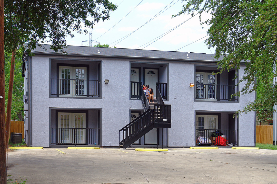
Photos


Request Notification
309 W Aviation Blvd
Universal City, TX 78148

- Studio Bedrooms
About 309 W Aviation Blvd
At 309 W Aviation Blvd in Universal City, TX, find a great place to live. This community can be found in the Outer Northeast area of Universal City. From pricing to features, the professional leasing staff is excited to help you find your perfect floorplan. It's time to love where you live. Stop by for a visit today.
Description created using real-time rental pricing and availability.
309 W Aviation Blvd is located in the Universal City Park Neighborhood and 78148 Zip code of Universal City, TX.
Property Contact Info
Floorplan Pricing and Availability
New! Interactive Property Map
Studio
Studio
Studio,Availability Details
Availability Date Unit Unavailable Studio
Property Information
- 4 Units
- 2 Stories
- Built in 1986
You are leaving ApartmentHomeLiving.com…
Fees and Policies
Property Fee Disclaimer: Based on community-supplied data and independent market research. Subject to change without notice. May exclude fees for mandatory or optional services and usage-based utilities.
Map
- Shopping
- Colleges
- Grocery
- Medical
- Nearby Properties

Map
What Are Walk Score®, Transit Score®, and Bike Score® Ratings?
- Walk Score® measures the walkability of any address.
- Transit Score® measures access to public transit.
- Bike Score® measures the bikeability of any address.
Renters Reviews and Ratings
Nearby Schools
Ray D Corbett J High School
Samuel Clemens High School
Rose Garden Elementary School
Barbara Jordan Intermediate School
About GreatSchools Data on ApartmentHomeLiving.com.
Points of Interest
Time and distance from 309 W Aviation Blvd.
Big Box and Retail
Walmart
Kohl's
Target
Colleges and Universities
Groceries
Heb
H-E-B Cibolo
Lidl
Hospitals
Brooke Army Medical Center (Fort Sam Houston)
Military Bases
Randolph Air Force Base
Martindale Army Airfield
Fort Sam Houston
Shopping Centers
309 W Aviation Blvd has 5 shopping centers within 1.0 miles.
Nearby Neighborhoods
Rental Price Ranges in the Area
| Bedroom | Average Rent | Cheapest Rent | Highest Rent |
|---|---|---|---|
| Universal City Studio Apartments | $910 | $725 | $1,350 |
| Universal City 1 Bedroom Apartments | $1,110 | $770 | $2,560 |
| Universal City 2 Bedroom Apartments | $1,325 | $850 | $2,545 |
| Universal City 3 Bedroom Apartments | $1,782 | $999 | $4,492 |
| Universal City 4 Bedroom Apartments | $2,339 | $1,199 | $2,625 |
Nearby Apartments
Nearby Homes
Did You Know?
22% of apartment shoppers plan to spend 4-6 months in their apartment search.