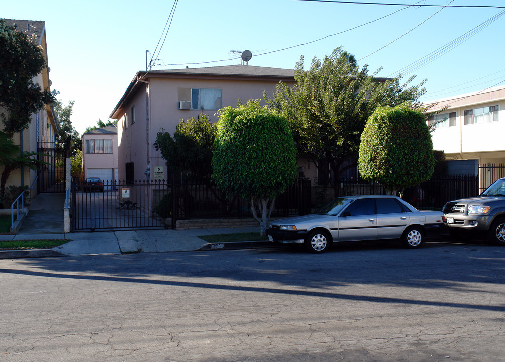
Photos


Request Notification
334 W Lime St
334 W Lime St
Inglewood, CA 90301
Inglewood, CA 90301

About 334 W Lime St
334 W Lime St is located in the 90301 Zip code of Inglewood, CA.
Property Contact Info
This property is currently does not have availability listed on ApartmentHomeLiving.com. Sign-up to get notified when it becomes available.
Property Information
- 6 Units
- 2 Stories
You are leaving ApartmentHomeLiving.com…
Before navigating to this property's external website, would you like to contact them for more information?
Map
334 W Lime St, Inglewood, CA 90301
- Shopping
- Colleges
- Grocery
- Medical
- Parks
- Transportation
- Nearby Properties

Map
Getting Around
Walk Score®
78 / 100
Very Walkable
Most errands can be accomplished on foot
Bike Score®
62 / 100
Bikeable
Some bike infrastructure
Transit Score®
53 / 100
Good Transit
Many nearby public transportation options
What Are Walk Score®, Transit Score®, and Bike Score® Ratings?
- Walk Score® measures the walkability of any address.
- Transit Score® measures access to public transit.
- Bike Score® measures the bikeability of any address.
Renters Reviews and Ratings
Nearby Schools
Hudnall (Claude) Elementary
Inglewood Unified
331 West Olive Street
Public School - Grades K-6 (388 Students)
In Attendance Zone1 minute drive / 0.2 miles away
Crozier (George W.) Middle
Inglewood Unified
1210 West Regent Street
Public School - Grades 7-8 (306 Students)
In Attendance Zone1 minute drive / 0.6 miles away
Morningside High
Inglewood Unified
10500 Yukon Avenue South
Public School - Grades 9-12 (535 Students)
In Attendance Zone5 minute drive / 1.9 miles away
School data provided by GreatSchools.
details
The GreatSchools Rating helps parents compare schools within a state based on a variety of school quality indicators and provides a helpful picture of how effectively each school serves all of its students. Ratings are on scale of 1 (below average) and to 10 (above average) and can include test scores, college readiness, academic progress, advanced courses, equity, discipline and attendance data. We also advise parents to visit schools, consider other information on school performance and programs, and consider needs as part of the school selection process.
About GreatSchools Data on ApartmentHomeLiving.com.
About GreatSchools Data on ApartmentHomeLiving.com.
Points of Interest
Time and distance from 334 W Lime St.
Arts Museums and Landmarks
Big Box and Retail
Target
3471 W Century Blvd
5 minute drive / 1.72 miles away
Costco
3560 W Century Blvd
5 minute drive / 1.93 miles away
Staples
8704 S Sepulveda Blvd
4 minute drive / 2.05 miles away
Colleges and Universities
Groceries
Vons
500 E Manchester Blvd
1 minute drive / 0.62 miles away
Ralphs
950 N La Brea Ave
3 minute drive / 1.08 miles away
Smart & Final
1575 Centinela Ave
3 minute drive / 1.2 miles away
Hospitals
Centinela Hospital Medical Center
555 East Hardy Street
3 minute drive / 1.01 miles away
Cedars-Sinai Marina Del Rey Hospital
4650 Lincoln Blvd
10 minute drive / 4.83 miles away
Kaiser Foundation Hospital - West La
6041 Cadillac Ave
11 minute drive / 5.47 miles away
Military Bases
6 minute drive / 3.15 miles away
10 minute drive / 5.13 miles away
Parks and Recreation
334 W Lime St has 5 parks within 10.5 miles, including Exposition Rose Garden, La Brea Tarpits, Beverly Gardens Park, Santa Monica Pier, and Barnsdall Art Park.
Restaurants and Dining
Shopping Centers
334 W Lime St has 5 shopping centers within 0.5 miles.
Transit Stations
Nearby Neighborhoods
Rental Price Ranges in the Area
| Bedroom | Average Rent | Cheapest Rent | Highest Rent |
|---|---|---|---|
| Inglewood Studio Apartments | $2,119 | $812 | $4,738 |
| Inglewood 1 Bedroom Apartments | $2,520 | $895 | $7,288 |
| Inglewood 2 Bedroom Apartments | $3,105 | $929 | $7,273 |
| Inglewood 3 Bedroom Apartments | $3,553 | $1,200 | $6,810 |
| Inglewood 4 Bedroom Apartments | $5,324 | $1,225 | $8,400 |
| Inglewood 5 Bedroom Apartments | $3,800 | $3,800 | $3,800 |
Nearby Apartments
Nearby Homes
Did You Know?
28% of apartment shoppers plan to spend at least 1-2 months in their apartment search.