Photos

Request Notification
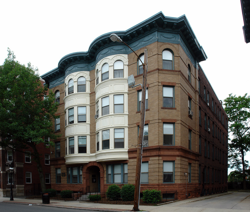
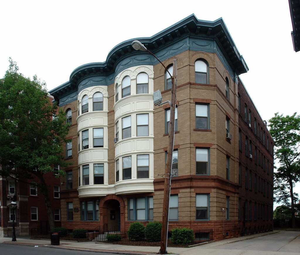
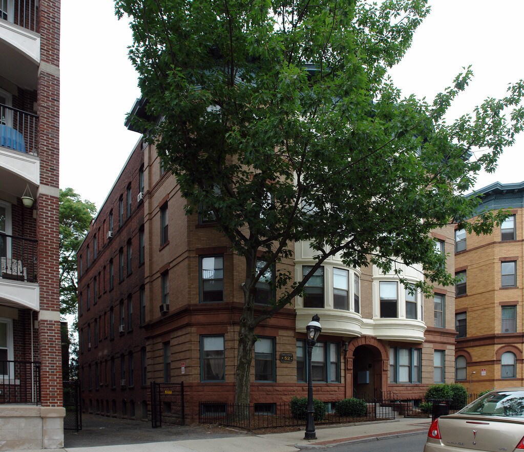
52 High St
52 High St
Springfield, MA 01105
Springfield, MA 01105

About 52 High St
At 52 High St in Springfield, MA, you've discovered your new place. With studio to 0 bedroom apartment options. The community staff is ready to help you find the perfect apartment. It's all waiting for you at 52 High St. Contact or drop by the leasing office to schedule your tour.
Description created using real-time rental pricing and availability.
52 High St is located in the Downtown Springfield Neighborhood and 01105 Zip code of Springfield, MA.
Property Contact Info
This property is currently does not have availability listed on ApartmentHomeLiving.com. Sign-up to get notified when it becomes available.
Property Information
- 16 Units
- 4 Stories
- Built in 1830
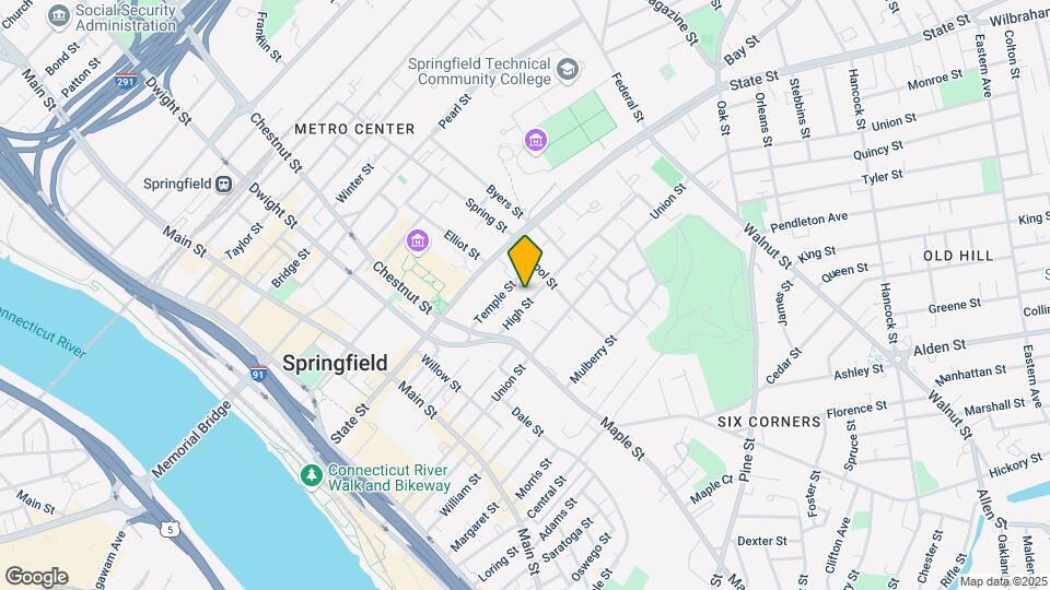
Map
52 High St, Springfield, MA 01105
- Shopping
- Colleges
- Grocery
- Medical
- Nearby Properties
Map
Getting Around
Walk Score®
84 / 100
Very Walkable
Most errands can be accomplished on foot
Bike Score®
47 / 100
Somewhat Bikeable
Minimal bike infrastructure
Transit Score®
76 / 100
Excellent Transit
Transit is convenient for most trips
What Are Walk Score®, Transit Score®, and Bike Score® Ratings?
- Walk Score® measures the walkability of any address.
- Transit Score® measures access to public transit.
- Bike Score® measures the bikeability of any address.
Renters Reviews and Ratings
Nearby Schools
High School Of Commerce
Springfield
415 State Street
Public School - Grades 9-12 (1103 Students)
In Attendance Zone1 minute drive / 0.3 miles away
South End Middle School
Springfield
36 Margaret Street
Public School - Grades 6-8 (187 Students)
In Attendance Zone1 minute drive / 0.4 miles away
Milton Bradley School
Springfield
22 Mulberry Street
Public School - Grades PK-5 (515 Students)
In Attendance Zone1 minute drive / 0.1 miles away
Springfield Public Day Middle School
Springfield
732 Chestnut Street
Public School - Grades 6-8 (51 Students)
In Attendance Zone5 minute drive / 1.7 miles away
Springfield High School
Springfield
Dickenson Bldg 37 Alderman St
Public School - Grades 9-12 (203 Students)
In Attendance Zone4 minute drive / 1.5 miles away
School data provided by GreatSchools.
details
The GreatSchools Rating helps parents compare schools within a state based on a variety of school quality indicators and provides a helpful picture of how effectively each school serves all of its students. Ratings are on scale of 1 (below average) and to 10 (above average) and can include test scores, college readiness, academic progress, advanced courses, equity, discipline and attendance data. We also advise parents to visit schools, consider other information on school performance and programs, and consider needs as part of the school selection process.
About GreatSchools Data on ApartmentHomeLiving.com.
About GreatSchools Data on ApartmentHomeLiving.com.
Points of Interest
Time and distance from 52 High St.
Big Box and Retail
Autozone
606 State St
2 minute drive / 0.81 miles away
Walgreens
50 Saint James Blvd
5 minute drive / 2.51 miles away
Aldi
903 Riverdale St
6 minute drive / 3.0 miles away
Colleges and Universities
Groceries
Aldi
903 Riverdale St
6 minute drive / 3.0 miles away
Stop & Shop
28 Lincoln St
17 minute drive / 8.13 miles away
Big Y
44 Willimansett St
18 minute drive / 8.49 miles away
Hospitals
Mercy Medical Center
271 Carew Street
4 minute drive / 1.35 miles away
Shriners Hospital For Children
516 Carew Street
4 minute drive / 1.54 miles away
Baystate Medical Center
759 Chestnut Street
4 minute drive / 2.01 miles away
Military Bases
14 minute drive / 6.69 miles away
18 minute drive / 8.55 miles away
Shopping Centers
52 High St has 5 shopping centers within 1.4 miles.
Nearby Neighborhoods
Rental Price Ranges in the Area
| Bedroom | Average Rent | Cheapest Rent | Highest Rent |
|---|---|---|---|
| Springfield Studio Apartments | $1,522 | $895 | $3,475 |
| Springfield 1 Bedroom Apartments | $1,767 | $1,050 | $4,135 |
| Springfield 2 Bedroom Apartments | $1,892 | $1,239 | $4,730 |
| Springfield 3 Bedroom Apartments | $1,895 | $1,481 | $2,500 |
| Springfield 4 Bedroom Apartments | $2,335 | $2,000 | $3,000 |
Nearby Apartments
Nearby Homes
Did You Know?
The average 1 Bedroom Apartment in Springfield is $1,767.