Photos


Request Notification
5229 El Camino Ave
Carmichael, CA 95608

About 5229 El Camino Ave
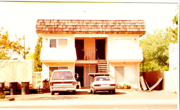
Explore your new home at 5229 El Camino Ave. The Outer Carmichael Citrus Heights location is an ideal place for residents. The professional community team is waiting to show you all that this community has in store. Select between studio to 0 bedroom floorplans. Drop by the leasing office to find out the current pricing.
Description created using real-time rental pricing and availability.
5229 El Camino Ave is located in the Outer Carmichael Citrus Heights Neighborhood and 95608 Zip code of Carmichael, CA.
Property Contact Info
Property Information
- 4 Units
- Built in 1979
Map
- Shopping
- Colleges
- Grocery
- Medical
- Parks
- Transportation
- Nearby Properties

Map
Getting Around
Walk Score®
56 / 100
Somewhat Walkable
Some errands can be accomplished on foot
Bike Score®
60 / 100
Bikeable
Some bike infrastructure
What Are Walk Score®, Transit Score®, and Bike Score® Ratings?
- Walk Score® measures the walkability of any address.
- Transit Score® measures access to public transit.
- Bike Score® measures the bikeability of any address.
Renters Reviews and Ratings
Nearby Schools
Starr King K-8
El Camino Fundamental High
About GreatSchools Data on ApartmentHomeLiving.com.
Points of Interest
Time and distance from 5229 El Camino Ave.
Big Box and Retail
Colleges and Universities
Groceries
Hospitals
Military Bases
Parks and Recreation
5229 El Camino Ave has 5 parks within 8.6 miles, including Sunrise Recreation Areas, Sutter's Landing Regional Park, Sutter's Fort State Historical Park, Paradise Beach, and South Natomas Community Park.
Shopping Centers
5229 El Camino Ave has 5 shopping centers within 0.6 miles.
Transit Stations
Nearby Neighborhoods
Rental Price Ranges in the Area
| Bedroom | Average Rent | Cheapest Rent | Highest Rent |
|---|---|---|---|
| Carmichael Studio Apartments | $1,403 | $946 | $2,209 |
| Carmichael 1 Bedroom Apartments | $1,702 | $888 | $5,636 |
| Carmichael 2 Bedroom Apartments | $1,971 | $1,061 | $4,795 |
| Carmichael 3 Bedroom Apartments | $2,419 | $1,219 | $4,043 |
| Carmichael 4 Bedroom Apartments | $2,599 | $2,599 | $2,599 |
Nearby Apartments
Nearby Homes
Did You Know?
Apartment residents stay an average of 2.5 years in their apartment before moving.