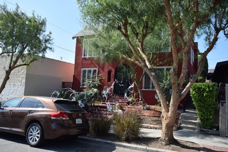
Photos


Request Notification
113-115 1/2 Robinson St
Los Angeles, CA 90026

- 1–2 Bedrooms
- 796Square Feet
About 113-115 1/2 Robinson St
Find your new home at 113-115 1/2 Robinson St in Los Angeles. Situated in Los Angeles's 90026 neighborhood, living here gives you a number of nearby experiences. The team of leasing professionals is ready and waiting for you to come by for a tour. Come see 113-115 1/2 Robinson St today.
Description created using real-time rental pricing and availability.
113-115 1/2 Robinson St is located in the Rampart Village Neighborhood and 90026 Zip code of Los Angeles, CA.
Property Contact Info
Floorplan Pricing and Availability
New! Interactive Property Map
1 Bedroom
1 Bed, 1 bath
1 Bed, 1 Bath, 796 sq ftAvailability Details
Availability Date Unit Sq Ft Unavailable 1 Bed, 1 bath 796 sq ft 2 Bedrooms
2 Beds, 1 bath
2 Beds, 1 Bath, 796 sq ftAvailability Details
Availability Date Unit Sq Ft Unavailable 2 Beds, 1 bath 796 sq ft
Property Information
- 4 Units
- 2 Stories
- Built in 1923
Map
- Shopping
- Colleges
- Grocery
- Medical
- Parks
- Transportation
- Nearby Properties

Map
Getting Around
Walk Score®
90 / 100
Walker’s Paradise
Daily errands do not require a car
Bike Score®
70 / 100
Very Bikeable
Biking is convenient for most trips
Transit Score®
71 / 100
Excellent Transit
Transit is convenient for most trips
What Are Walk Score®, Transit Score®, and Bike Score® Ratings?
- Walk Score® measures the walkability of any address.
- Transit Score® measures access to public transit.
- Bike Score® measures the bikeability of any address.
Renters Reviews and Ratings
Nearby Schools
Virgil Middle
Commonwealth Avenue Elementary
Belmont Senior High
Contreras Learning Center-Los Angeles School Of Global Studies
Lafayette Park Primary Center
About GreatSchools Data on ApartmentHomeLiving.com.
Points of Interest
Time and distance from 113-115 1/2 Robinson St.
Arts Museums and Landmarks
Big Box and Retail
Colleges and Universities
Groceries
Hospitals
Parks and Recreation
113-115 1/2 Robinson St has 5 parks within 7.4 miles, including Barnsdall Art Park, Exposition Rose Garden, Bronson Canyon, La Brea Tarpits, and Beverly Gardens Park.
Restaurants and Dining
Shopping Centers
113-115 1/2 Robinson St has 5 shopping centers within 0.6 miles.
Transit Stations
Nearby Neighborhoods
Rental Price Ranges in the Area
| Bedroom | Average Rent | Cheapest Rent | Highest Rent |
|---|---|---|---|
| Los Angeles Studio Apartments | $2,211 | $795 | $10,000+ |
| Los Angeles 1 Bedroom Apartments | $2,862 | $645 | $10,000+ |
| Los Angeles 2 Bedroom Apartments | $3,762 | $899 | $10,000+ |
| Los Angeles 3 Bedroom Apartments | $5,115 | $1,075 | $10,000+ |
| Los Angeles 4 Bedroom Apartments | $2,729 | $925 | $10,000+ |
| Los Angeles 5 Bedroom Apartments | $2,180 | $1,045 | $10,000+ |
| Los Angeles 6 Bedroom Apartments | $8,928 | $1,250 | $10,000+ |
Nearby Apartments
Nearby Homes
Did You Know?
The average Apartment shopper researches 4 properties in detail before signing a lease.